- Location
- Year
- Category
- Program
- Ibaraki 茨城
- 2011.9 –
- Competition
- Urban design
UIA Competition
Ibaraki, 2011.9 –
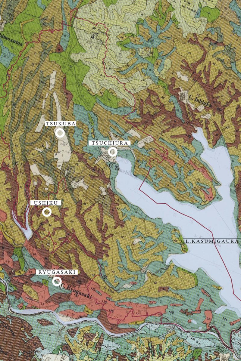
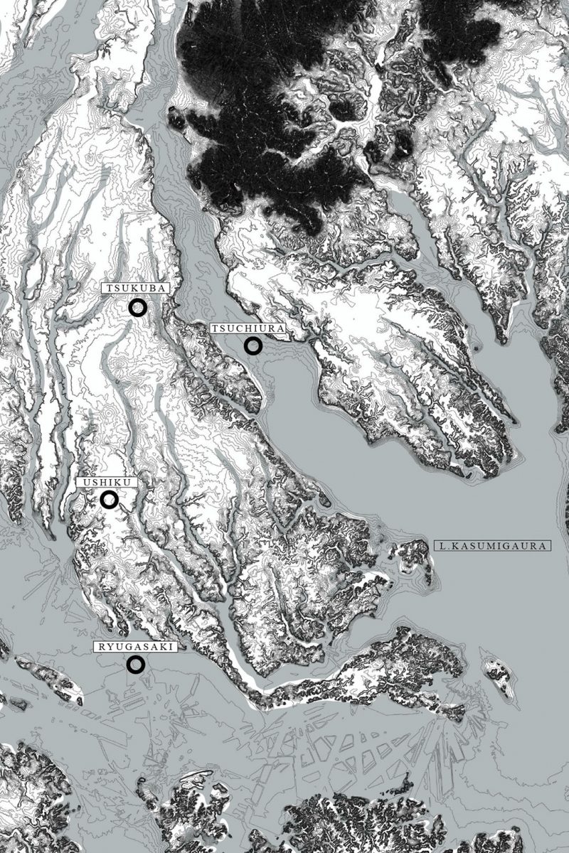
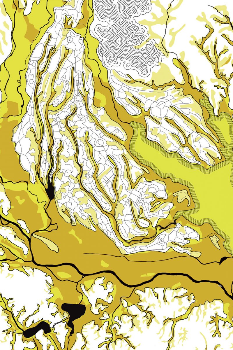
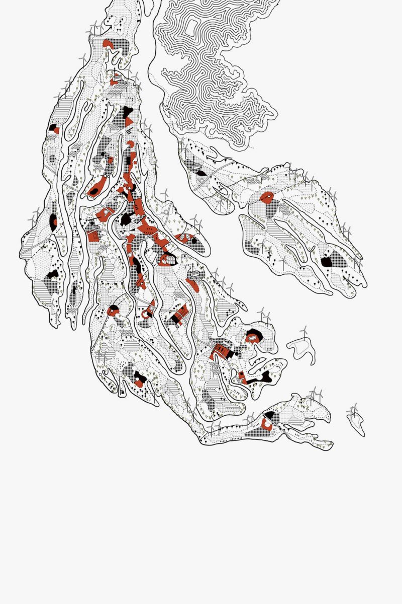
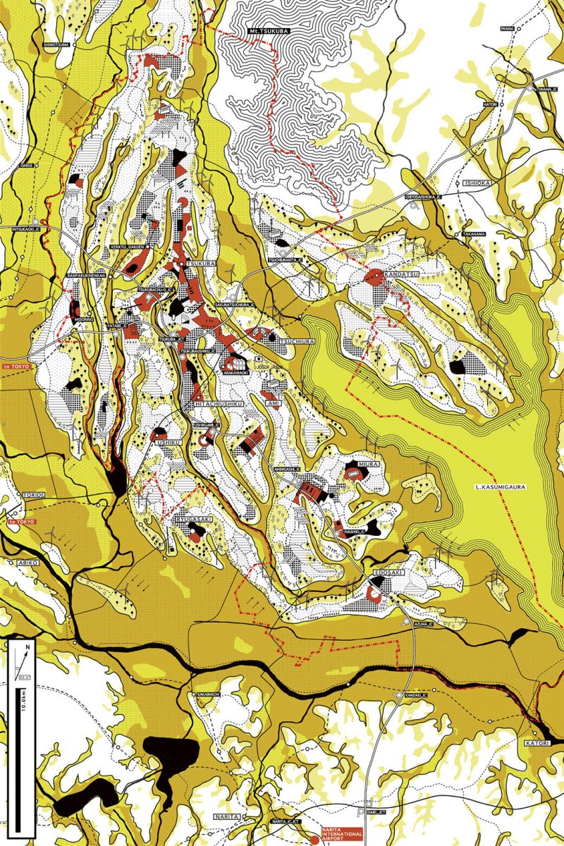
茨城県南東部にある大きな湖、霞ヶ浦の周辺の都市計画。2011年3月に発生した東日本大震災から半年後に開かれた設計競技で、液状化で大きな被害を受けた土浦市などを含む茨城県南部の沿岸エリア広域(KSCR, Kasumigaura Southern Coastal Region)を対象とし、2050年の都市計画の可能性を問うものでした。そこで本計画では、新しい都市計画の骨格として「GEO POTENTIAL GRID」を提案しました。GEO POTENTIAL GRIDは、地形図(Topographical map)と地質図(Soil map)から成っており、地形図は台地と低地を、地質図は安定した岩盤か不安定な沖積層かを示しています。それらを統合して考えて、台地で安定した岩盤の上に都市を、低く肥沃な沖積層の地域に耕作地を配置するという単純明快なルールが「GEO POTENTIAL GRID」のシステムです。この配置が示したのは、震災の被害の多かった地域は、やはり低地で不安定な沖積層に属していたということでした。このシステムは、新しい「発明」のようでいて、すでにその土地に古くからある情報を整理しただけの「発見」ということです。都市の基盤は昔からある地面そのものが、常に教えてくれているものだということです。「GEO POTENTIAL GRID」をもとに都市計画を再構成すると、敷地の特性上一つ一つの街は複雑な地形に沿って分断され離散的な都市配置となり、現代の都市のように平面的に展開することが難しくなります。しかし、その多少の不便を受け入れることこそ、今の都市計画に大切なことなのです。また技術の進歩は、このような都市計画に舵を切れば直ぐにそこに追いついて発達をすることでしょう。日本中どこに行っても同じような風景では、地方には魅力はなく大都市以外の小都市は淘汰されていきます。その土地の特性に耳を傾け、その土地でしかない暮らし方をすることがこれからの都市計画だというのが本提案です。そしてその風景は、大海に浮かぶ島で豊かで多様な暮らしをする世界の縮図のようなものだと思うのです。「An Island On the Ocean」
Urban planning around Kasumigaura, a large lake in the southeastern part of Ibaraki Prefecture. A design competition held six months after the Great East Japan Earthquake in March 2011, targeting the KSCR (Kasumigaura Southern Coastal Region) in the southern part of Ibaraki Prefecture, including Tsuchiura City, which was severely damaged by liquefaction. It was to question the potential of urban planning in 2050. In this plan, we proposed "GEO POTENTIAL GRID" as a framework of new city planning. GEO POTENTIAL GRID consists of a topographical map and a soil map. The topographical map shows plateaus and lowlands, and the soil map shows stable rock or unstable alluvium. The "GEO POTENTIAL GRID" system is based on a simple and clear rule that considers integrating them and arranging cultivated lands in low and fertile alluvial areas, with cities on stable rocks on plateaus. This arrangement indicated that the areas most affected by the earthquake belonged to lowland and unstable alluvial deposits. This system, like a new "invention", is a "discovery" that simply sorts out information that has already existed on the land for a long time. The foundation of the city is what the old ground itself is always telling us. When reconstructing city planning based on "GEO POTENTIAL GRID", due to the characteristics of the site, each city is divided along complex terrain, resulting in a discrete city arrangement, which makes it difficult to develop on a flat surface like a modern city. However, accepting some of the inconvenience is important in today's urban planning. Also, technological advances will catch up and develop as soon as we turn to such urban planning. No matter where you go in Japan, if the scenery is the same, there is no charm in rural areas and small cities other than large cities will be eliminated. And the landscape is like a microcosm of a world where people live rich and diverse on islands floating in the ocean. "An Island On The Ocean"
用途: 都市計画 / 所在: 茨城 日本 / 製作年: 2011 / 受賞: UIA TOKYO 2011(世界建築会議)Student Competition UIA賞(最優秀賞)
Program: Urban Design / Location: Ibaraki Japan / Year: 2011 / Award: UIA competition for diploma project
